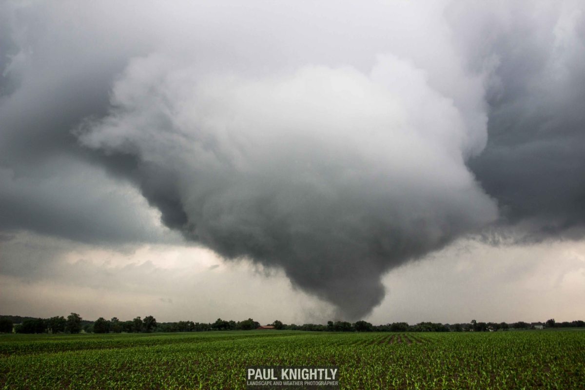
Chasecation 2016: Wamego-Louisville Tornado
Even though I live in the heart of tornado alley, and severe weather is often easily accessible from home, it has still been a desire of mine for the last couple of years to embark on a dedicated “chasecation.” That is to say, taking time off deliberately during the peak of severe weather season to chase storms across the plains. Due to obligations at my day job as a geologist for an environmental consulting firm, I must make this request for time off weeks to months in advance – for too early in terms of being able to accurately forecast if that period will see active weather or not.
At the start of April, I tentatively targeted the end of May/first part of June as when I would chase. The end of May into the start of June typically provides the volatile environmental conditions necessary for the big storms the plains are known for. I could not have known in early April that taking the last full week of May would have been the better option – that week saw an outbreak of tornadoes and storms, especially across western Kansas, that will be talked about for years to come. I managed to tap into some of that busy weather pattern before embarking on what turned into an abbreviated chasecation May 31 through June 2 due to poor weather conditions (aka – blue skies.) This is my first write-up of three covering my chasing adventures around my chasecation.
May 26, 2016 – Wamego, Kansas
Thursday May 26 was rock-bottom of a pretty rough week for me as a storm chaser. The Saturday before saw the incredible supercell near Leoti, Kansas and only two days had passed since a powerful storm spawned some of the most photogenic tornadoes of the year near Dodge City – all of which were storms I sat out due to other obligations and commitments at work. But the morning weather outlook was increasingly favorable for strong severe weather activity closer to home.
By mid-day, the probabilities of severe weather were too high and too close to home for me to keep sitting around, so I burned vacation time and took the rest of the afternoon off.


The morning convective and tornado outlooks from the Storm Prediction Center (SPC).
I left the office around 1230 with the intention of driving west to somewhere between Salina and Manhattan, KS. But by the time I reached the west side of Topeka, it was clear that the atmosphere had other plans. I drove through an intensifying thunderstorm that while it was demonstrating some weak rotation and putting on an incredible lightning show, chasing it would be difficult. Doing so would require figuring out a way to cross the Kansas River where bridges were scarce and to navigate curvy roads through the trees and hills of northeast Kansas. Not ideal chasing terrain if better storms formed further west.
And I didn’t need to travel far. About 10 miles from reaching the exit to Wamego along I-70, a small non-descript thunderstorm that had only been alive for about 30 minutes got slapped with a tornado warning by the National Weather Service (NWS) in Topeka. I exited the highway and drove north, quickly getting a visual on the southwestern end of the storm that was indeed demonstrating weak rotation. I stopped a mile south of Wamego and pulled off onto a dirt road – my preferred method of setting up an observation point as it keeps me from blocking or distracting traffic on busier highways or roads. I was just in time to watch the storm cycle (a term for the storm passing from an organized, to disorganized, and back to an organized state) and begin dropping funnel clouds.
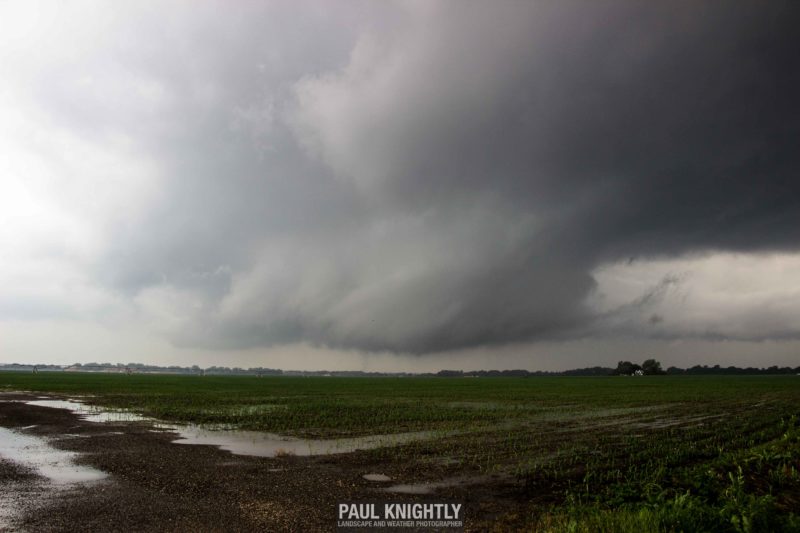
Wall cloud about 2 miles south of Wamego. A very faint, whispy funnel cloud can be seen “licking” the ground near the center of the image.
I didn’t watch the storm from this position for long. Just a few minutes of watching the storm’s motion was all I needed to know I needed to shift east and south just a smidge. to avoid having the wall cloud pass over top of me. While I was closer than I would have liked to have been, the size of the wall cloud and other visual cues from the storm, I knew with a fair degree of certainty I would be fine. As it passed roughly half a mile to my west, an area of wide circulation reached the ground and began flinging dirt and tree limbs into the air. The tornado was on the ground and only the Kansas River stood between the rapidly developing tornado and the heart of Wamego.
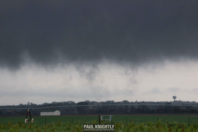
The still very weak tornado can be seen lofting dirt into the air as it prepares to cross the Kansas River. The water tower in the middle of Wamego can be seen on the lower right.
As the tornado moved across Wamego, I was extremely concerned about what I was possibly witnessing. Would the circulation tighten up and the tornado intensify right over town? I could see tree limbs and other small debris getting lofted into the air above several city blocks, but the tornado lifted, allowing myself and other onlookers an opportunity to cast a sigh of relief.
I cautiously drove into town along K-99 to follow the storm north, tornado sirens still blazing. I looked down side streets to make sure no significant damage had been done, and seeing all structures intact and only tree limbs littering the city streets, I continued onward. Just after passing the intersection with Highway 24, I stopped as the funnel cloud reformed, only more defined than before. Though my view was obscured by trees and the storm now a mile ahead of me, I could tell it was reaching the ground on the north side of town.
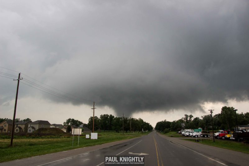
Tornado on the ground on the north side of Wamego.
Crossing the damage path of the tornado in-progress north of Wamego, I drove a couple miles down the road and directly behind the storm to get a better vantage point of the tornado. I found myself situated just south of the smaller town of Louisville and pulled off on a dirt road about half a mile behind the tornado. If I had video rolling, all I would I have been heard saying is “oh, no” over and over. The storm was doing structural damage to some outbuildings on a farm to my north. I could see that the buildings were taking the beating but losing a lot of shingles and roofing in the process. I got my clearest shots of the tornado at this point.
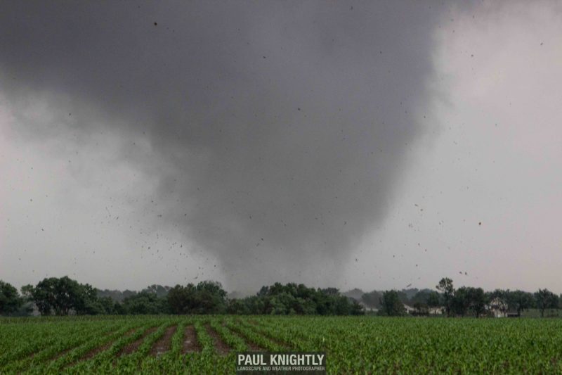
Building debris and tree limbs being circulated around the base of the tornado south of Louisville, KS.
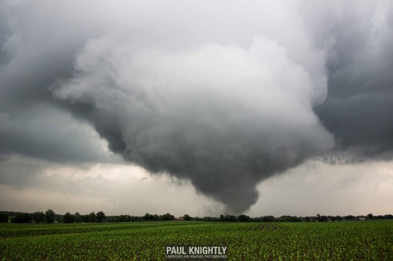
Wider shot of the tornado and associated wall cloud as it was doing damage south of Louisville, KS.
As I continued north on K-99 to follow the storm, a stream of local emergency management and law enforcement personnel were in tail – turning down side streets to check in on homes that had only been hit by the tornado mere minutes before. I kept my distance and yielded to their movements – the scale and immediacy of their response was impressive, and my compliments go out to the first responders of Pottawatomie County for an extremely organized response effort.
The tornado was beginning to elongate into a trunk as it crossed over open country north of Louisville. I was now a couple of miles behind it, and feeling that with it’s present appearance and history of doing increasingly destructive damage, I kept the 2 mile buffer and gave it space to do its thing, although there were already signs that it would soon start to weaken.
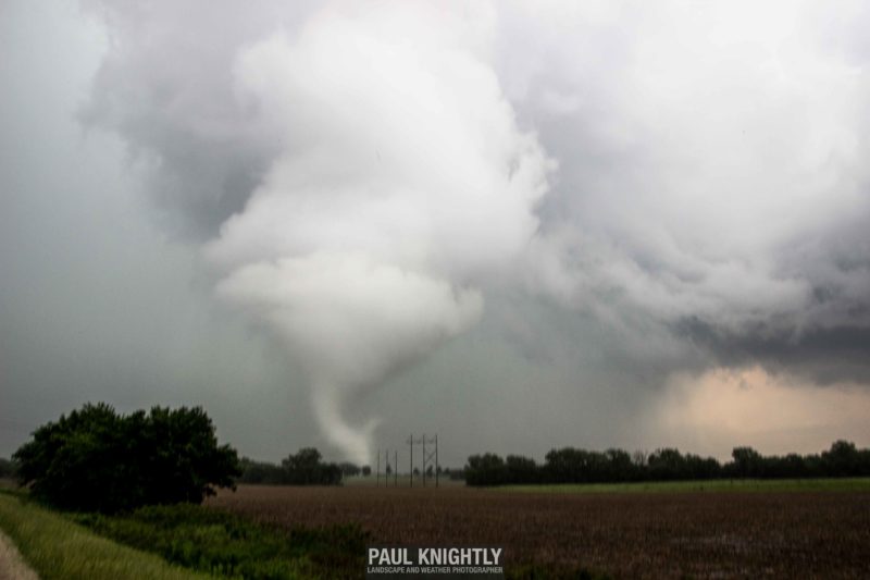
Tornado elongating into a trunk and the wall cloud becoming more diffuse in the process.
The tornado soon roped out and I captured the sequence just off the side of K-99. The lighting wasn’t the greatest, but it was some of the best tornadic structure I had seen from the storm all afternoon. Just before it totally dissipated, I zoomed in and was able to see the intricate vortices circling the “tube” of the tornado.

Tornado roping out.
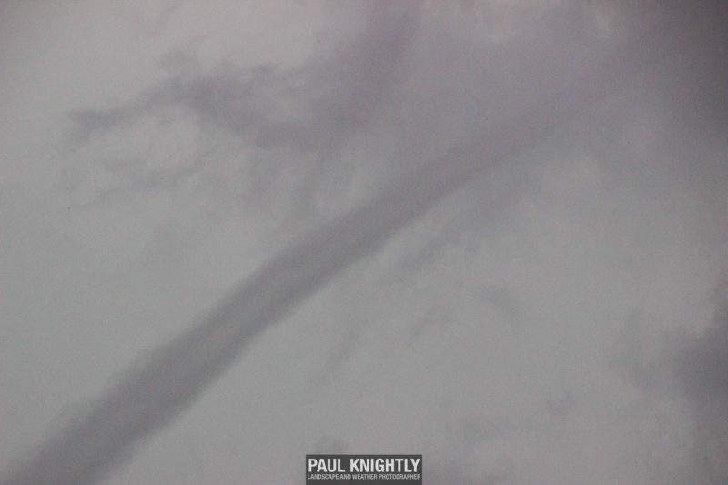
Rope out: Vortices visible around the main center of circulation for the tornado on the lower left.
As I got into my car after the tornado dissipated, I tuned into 94.5 FM out of Topeka to see if there was any damage being reported. To my relief, no homes were lost nor any injuries reported. As I began the 2-hour drive home and thought over the chase in my head, an image kept popping into my head. While I was watching the storm hit a farmstead in Louisville, I looked up at the farm house I was parked in front of to see the homeowner standing there – gaze locked on the tornado. As he was watching the tornado inflict damage onto his neighbor’s property, a look of despair and concern could be seen on his face. That is an image I will always carry in my mind from this strom.
I love watching and chasing storms – the weather is fascinating to me. But storms like this have a very real impact in people’s lives. For all my longing for storm season, I hate seeing storms do this. At the end of the day, my passion for severe weather is tied to the respect that it commands. The Wamego-Louisville tornado certainly reinforced that for me.


